


Thomas 10 Voting District, Graham County, Arizona
About
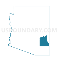
Outline

Summary
| Unique Area Identifier | 523830 |
| Name | Thomas 10 Voting District |
| County | Graham County |
| State | Arizona |
| Area (square miles) | 201.40 |
| Land Area (square miles) | 200.96 |
| Water Area (square miles) | 0.45 |
| % of Land Area | 99.78 |
| % of Water Area | 0.22 |
| Latitude of the Internal Point | 33.07666910 |
| Longtitude of the Internal Point | -109.97204600 |
Maps


Graphs
Select a template below for downloading or customizing gragh for Thomas 10 Voting District, Graham County, Arizona


Neighbors
Neighoring Voting District (by Name) Neighboring Voting District on the Map
- Bylas 11 Voting District, Graham County, AZ
- Klondyke 12 Voting District, Graham County, AZ
- Peridot 16 Voting District, Graham County, AZ
- Pima 9 Voting District, Graham County, AZ